Captain Sams Update
In light of the South Carolina House of Representative’s unanimous approval of Senate Bill 139, which will allow for one more baseline delineation as Kiawah Partners had been requesting, we would like to update you on our plans for Captain Sams and set the record straight on our lobbying efforts in Columbia.
Despite what some media outlets and our opposition would have you to believe, our efforts in Columbia were never intended to change the existing law nor delay the next baseline delineation. We just asked that the next required cycle of delineation that was written into law in the Beachfront Management Act in 1990 be completed before the legislature implemented a permanent baseline. Setting the line retroactively to 2009 would not have represented an up-to-date and accurate measurement nor would it have been fair to change the law at the 11th hour before the next delineation.
We believe that our constructive conversations with the members of the Legislature and the Department of Health and Environmental Control ultimately led to a fair and balanced bill that upholds the property rights of coastal land owners up and down the South Carolina coast and also protects and enhances our unique coastal environment.
Now that the legislation is behind us, we would also like to provide you some needed background and correct some of the inaccurate information that continues to be circulated. It is important that you have an accurate understanding of Captain Sams and our plans.
All of Captain Sams and the surrounding area is private property with the exception of the parking area and other facilities of Beachwalker Park which we lease to the Charleston County Parks and Recreation Commission to provide public access to Kiawah’s world renowned beach. We have a vested right to develop our property via a Development Agreement with the Town of Kiawah Island to create a sensitively planned neighborhood of up to 50 home sites. This vested right was created in 2009 when Kiawah Partners gave up the right to build a 325 room hotel on the property adjacent to Beachwalker Park.
As is the case with most of Kiawah, the Captain Sams beach has accreted continuously for more than 65 years. In the last 20 years, the land has grown from 119 acres of highland to more than 180 acres (now slightly less due to the relocation of the channel between Kiawah and Seabrook).
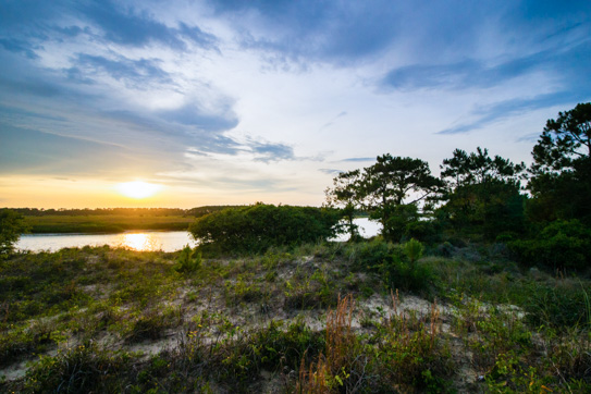
OCRM classifies Kiawah Island in its “State of the Beaches Report” as “one of the most stable barrier islands in the state” and the beach on the southwestern end has continuously accreted for more than 60 years. Depending on location, the accretion of the beach ranges from 6 to 15 feet per year. Future homes on the Captain Sams beachside will equal, and in many instances exceed, the voluntary setback distance of other oceanfront property on Kiawah which, when compared to other coastal communities, already well surpasses state requirements. The interior and backside of Captain Sams is highly vegetated with mature maritime vegetation. In other words, it is quite similar to the rest of Kiawah, particularly the fingers and islands that have been successfully developed using “Designing with Nature” guidelines.
As Kiawah property owners, you know that wildlife continues to live in harmony with us. Deer and bobcat still grace our lawns and common property; osprey, eagles, and thousands of other birds fly above our coastline, dolphins continue to thrive and feed in the Kiawah River. It will be no different at Captain Sams.
As for our development plan, the judge in the South Carolina Administrative Law Court provided an excellent overview in his recent order where he found: “The environmentally sensitive approaches that will be implemented in the limited residential development on Captain Sams include the following:
- Eschewing the development of typical grass yards and focusing on native grasses, xeriscaping (zero-scaping);
- Imposing significant setbacks of the development from not only the ocean but the primary, secondary, and tertiary dunes, with four to six rows of dunes between the beach and the developed area;
- Prohibiting houses from being taller than one and a half stories;
- Placing the houses among the trees;
- Using pervious materials instead of asphalt on driveways and the road wherever practicable;
- Combining dune walkovers for access from the houses to the beach so there would be a reduced number across the dune field on the Spit;
- Eliminating individual docks and limiting the docks along the Kiawah River to no more than one or two community docks;
- Prohibiting development on more than 80% of the Spit through a restriction and conservation easement;
- Working with a number of experts and scientists to enhance, restore, and enlarge the habitat available for a variety of birds and animals on the Spit;
- Placing the development, generally, within the forest canopy;
- Furnishing public utility services of water and sewer and prohibiting wells and septic tanks; prohibiting the random cutting of vegetation;
- Prohibiting anyone from building on the dunes;
- Using natural building sites and making them as small as practicable;
- Keeping the land around the buildable site in as close to an existing state as possible, retaining natural vegetation;
- Featuring indigenous plant material rather than imported plants;
- Implementing the development with a light touch, erring on the side of less rather than more, with infrastructure improvements as narrow as practical and minimizing runoff;
- Implementing shared pervious driveways;
- Making the homes and structures less prominent, treating them more as background;
- Eliminating parking under houses since it increases the elevation of the houses;
- Trying to limit lot size to the developed area; and
- Imposing strict restrictive covenants
This development of single family homesites will occur on no more than 20 acres of this private property. The remaining acreage will be placed into a conservation easement permanently preserving significant habitat for wildlife. No protected or endangered species live on the land which is to be developed, nor is the proposed development site in any sort of designated critical wildlife area.
The wintering piping plover habitat is well over 1,000 feet from the nearest future home site; the diamond back terrapin inhabit the tidal creeks across the Kiawah River from Captain Sams; and the bottlenose dolphins strand feed all up and down the Kiawah River including the western half of Captain Sams on the River where there is a non-eroding sand beach depending on tides.
As to erosion control, the South Carolina Administrative Law Court recently approved a full revetment of forty feet in width at the toe of the bulkhead for 270 feet, adjacent to Beachwalker Park. This is designed to prevent additional public parking spaces from being lost to erosion. In addition, the Court approved a bulkhead for a total length of 2,783 feet which takes it about one-half way down the River side of Captain Sams. This is designed to protect not only the roadway access to the neighborhood but much of the land in the conservation easement. Currently, the Court’s approval of the permit to construct the bulkhead and revetment has been stayed while it is heard by the South Carolina Supreme Court for a fourth time.
No public tax money or Kiawah Island Community Association funds will be involved in the unlikely event of major storm damage. We, the developer, and ultimately the neighborhood homeowner’s association, will be responsible for all infrastructure. No federal flood insurance will be available, as is the case in many developed areas of Kiawah and the surrounds. It should also be noted that no storm nor hurricane has topped the front dune ridge at Captain Sams for over 66 years and that includes Hurricane Hugo.
In summary, homeowners on Captain Sams will enjoy the same “Designed with Nature” lifestyle as do homeowners on the balance of Kiawah. This mantra has endured for over 40 years and will shine especially brightly at Captain Sams.
Best Regards,


